Haeundae gets the beach photos. Gwangalli gets the bridge. But leave a little room in your Busan itinerary for a wooded reservoir, a hillside lookout or a coastal path where the city suddenly feels much farther away.
These ten places are for that extra half-day, a second visit, or the moment your itinerary needs a breather. Some are local favourites rather than closely guarded secrets. The useful question is which one fits your day.
Choose one area at a time. Busan is too spread out to turn this list into a ten-stop challenge. If you only have one night, start with our Busan 2-day itinerary from Seoul and swap in one detour.
Which Busan detour suits you?
| If you want… | Start with | What to plan for |
|---|---|---|
| Big city views | Cheonmasan | Hills, different viewpoints and a clearly chosen destination |
| An unhurried coastal afternoon | Dadaepo or Songdo | A sunset plan or a shorter seaside walk |
| A proper walk beside the sea | Igidae | Steps, uneven sections and daylight |
| Temple grounds and mountain scenery | Beomeosa or Geumjeongsan | Choose a temple visit or a hiking route before leaving |
| Trees, water and a slower pace | Yongso, Hoedong or Seongjigok | Different access points; a lake on a map is not an entrance |
1. Cheonmasan: give the skyline some breathing room
Busan makes more sense from above: densely packed homes on the slopes, high-rise buildings behind them, and the harbour beyond. Cheonmasan is a good choice when you want that wider view after exploring the old city.

Get the name right before you go. Cheonmasan Sky Observatory (천마산 하늘전망대), the Sky Walk (천마산 하늘산책로) and the newer Observatory Complex (천마산 복합전망대) are different destinations. The photographs here show the existing hillside viewpoints.

The city’s June 2026 report describes the new complex as temporarily open, with access on foot from the Gamcheon Culture Village or Busan Education History Museum side. That notice listed Tuesday–Saturday, 10am–5pm, excluding public holidays; cafés were still being prepared. Treat those as temporary arrangements and check before travelling. A planned monorail should not be part of your transport plan yet.
Best fit: an old-city afternoon with time for uphill walking. Save your exact viewpoint and the return route before setting off. Busan city’s complex-opening report · Open 천마산 하늘전망대 in Naver Map · Open 천마산 복합전망대 in Naver Map.
2. Dadaepo: leave the evening unscheduled
Dadaepo is the pick for a long beach walk and a sunset with room around it. Arrive before the light starts changing; sprinting out of the subway to catch the last thirty seconds is a very different experience.
The beach park and Gowooni ecological boardwalk give you somewhere to wander before or after the main event. The Sunset Fountain is an optional extra: performances are seasonal, and weather or maintenance can change the schedule. Build the outing around the coast, then check whether a show fits.

Getting there: Line 1 to Dadaepo Beach Station (다대포해수욕장역). Visit Busan lists Exit 2 and about an eight-minute walk for the beach. That is a starting point for the main beach, not a promise that every boardwalk entrance is eight minutes away. Official beach and fountain information · Open 다대포해수욕장 in Naver Map.
3. Igidae and Oryukdo: a coastal walk with some bite
Igidae gives you the rocky, wilder-looking side of Busan’s coast. Wooden paths and steps trace the shoreline, with views back toward the city. It is a satisfying change from walking a flat beach promenade, but your legs will notice the difference.

For a shorter outing, explore one section and retrace your route. For a longer walk toward Oryukdo, choose the start and finish first and check the current trail notices. Do not assume a path is open simply because an older photograph shows it. Wet boards, strong wind and an approaching sunset are good reasons to shorten the plan.
Getting there: Visit Busan lists Line 2, Kyungsung University–Pukyong National University Station, Exit 5, then buses 20, 22, 24, 27, 39 or 131 to Igidae Entrance (이기대입구), followed by a walk of around fifteen minutes. Check the bus direction before boarding. Official Igidae route information · Open 이기대입구 in Naver Map.
4. Songdo: look beyond the cable-car photo
Songdo’s bay is an easy place to start a seaside afternoon. The quieter part of the plan is choosing a coastal walk instead of rushing between every attraction around the beach.

Three names can trip visitors up: Songdo Cloud Trails (송도구름산책로) near the beach, Songdo Coastal Trail (송도해안산책로) along the rocky shoreline, and Songdo Yonggung Suspension Bridge (송도용궁구름다리) near Amnam Park. They are separate places. Pick the one you mean in your map app.
Best fit: a shorter seaside detour from the old-city area. Start at the beach; only extend onto the cliffside route when the entrance is open and conditions are suitable. Keep the beach promenade as your fallback. Official Songdo coastal-walk guide · Open 송도해안산책로 in Naver Map.
5. Beomeosa: a quieter kind of Busan morning
Beomeosa trades beachfront towers for traditional roofs, stone details and a wooded mountain setting. Give yourself time to look at the gates and temple buildings. This is an active place of worship, so quiet observation works better than treating the grounds as a photo set.

A temple visit is already a worthwhile outing. Adding a mountain hike changes the day considerably; decide on that before leaving your hotel, not at the first trail sign.
Getting there: Line 1 to Beomeosa Station, Exit 5 or 7; walk to the Beomeosa Entrance bus stop (범어사입구), take bus 90, and get off at Beomeosa Ticket Office (범어사매표소). Visit Busan then lists about five minutes on foot. Despite the stop’s name, the official guide lists temple admission as free. Official Beomeosa visitor information · Open 범어사 in Naver Map.
6. Geumjeongsan and Geumjeongsanseong: make the mountain the plan
The forest and fortress walls around Geumjeongsan are the reason to bring walking shoes with grip. A gate framed by trees is a very different Busan photograph from the usual beach skyline.

Choose a named gate, a trail and a return point. “Geumjeongsanseong” covers a large area; a pin somewhere on the fortress is not a complete hiking plan. The aerial photograph shows how the wall runs through the landscape, not the view you should expect from every path.
Best fit: travellers who actively want a hike. A short fortress section and a summit outing have different demands, so resist adding an ambitious summit just because it looks close on a map. Official Geumjeongsan guide · Open 금정산성 in Naver Map.
7. Geumgang Park: an old-school forest escape
Geumgang Park has a pleasantly unhurried feel: wooded paths, places to pause, and a cable car that gives the outing a little old-school character. It suits a day when you want trees and fresh air without committing immediately to a long mountain route.
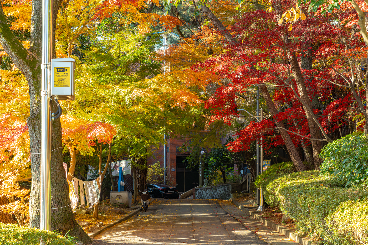
The cable car is a separate operating service; check its current hours and last return before buying a ticket. If you continue toward the fortress after riding up, remember that you are adding a hike, not simply strolling around the lower park.
Getting there: Line 1 to Oncheonjang Station, Exit 1. Visit Busan gives roughly twenty-two minutes on foot to the park. Search for the park or cable-car station specifically rather than following an unrelated mountain pin. Official park and cable-car overview · Open 금강공원 in Naver Map.
8. Yongso Wellbeing Park: a small Gijang reset
Save Yongso for a Gijang day when you want a break from the coast. Water, reflections and a wooded path do most of the work here. Bring a drink, leave some time unclaimed, and let a walk be the whole activity for once.

It makes most sense as a local detour within a Gijang outing. Travelling across the entire city just to squeeze in a quick photograph would miss the point.
Getting there: Visit Busan lists Gijang Station, Exit 1 on the Donghae Line, then a transfer at Gijang Catholic Church (기장성당) to village bus Gijang-gun 11. Get off at Seobu Jugong Apartments (서부주공아파트); allow about thirteen minutes for the final walk. Check the live bus timetable before choosing this route. Official Yongso access information · Open 용소웰빙공원 in Naver Map.
9. Hoedong Reservoir: the lake day you did not expect
Hoedong is for people who like a waterside walk to stretch into an afternoon. The reservoir, forest paths and hillside viewpoints offer a greener side of the city that can disappear from a beach-heavy itinerary.

Choose between staying near the water and climbing for a wider view. The elevated panorama in the photo involves a different effort from a gentle lakeside section. You do not need to complete a reservoir circuit to enjoy the place.
Before leaving: select your entrance and return transport together. The official guide locates this walk in Oryun-dong; use a named access point rather than a pin in the middle of the water. Official Hoedong walking guide · Open 회동수원지 둘레길 in Naver Map.
10. Seongjigok Reservoir: a green break from Seomyeon
If your base is Seomyeon, Seongjigok is a useful change of pace from shopping streets and cafés. The reservoir sits within Busan Children’s Grand Park, with woodland paths and places to stop by the water. The name may sound like a children-only outing; the walking routes are a reason to visit in their own right.

Keep to the reservoir walk if you want an easier outing. Following signs deeper into the mountains turns it into a different day.
Getting there: from Seomyeon Station, Exit 13, Visit Busan directs visitors to the stop across from the area behind Yeonggwang Bookstore (영광도서). Buses 54, 63, 81 or 133 serve Children’s Grand Park (어린이대공원); continue on foot into the park. Check the destination on the approaching bus. Official reservoir and transport guide · Open 부산 어린이대공원 in Naver Map.
How to fit these places into a real trip
Staying around Nampo or Busan Station? Pick Cheonmasan or Songdo for your main detour. Dadaepo can take a separate late afternoon. Allow for the transfer rather than treating the western coast as one continuous walk.
Staying in Seomyeon? Seongjigok is a good starting choice. Keep Beomeosa, Geumjeongsan and Geumgang Park as northern options; choose one main outing instead of forcing all three into a morning.
Already going to Gijang? Add Yongso. Want a more active coastal day? Make Igidae the main event and leave yourself an easy evening afterwards.
Save the Korean place names above and check current directions in Naver Map before departure. Station exits are starting points, not full routes: confirm the bus direction, the precise entrance and your way home. For mountain and coastal paths, daylight and weather matter more than ticking off another stop.
Sources and photo credits
This independently written guide was inspired by the destination ideas in Everyday Travel’s Busan hidden-spots video. Hoedong and Seongjigok were added through further research. Practical information was checked against the official sources linked in each section on 27 September 2026; operating arrangements can change.
All 11 photographs are supplied through the Busan Tourism Archive and marked KOGL Type 1 on their individual source pages. The photographer or producing organisation, source link and available archive date appear with each image. Archive photographs illustrate the destinations; they are not live condition reports. No AI-generated photographs are used.